Index of All Cemeteries Alphabetical Index of All Burials Previous Page
Use the following to search across all the cemeteries listed.
Example: "Smith, Roger" (yes, use the quotes)
191 NORMAN CEMETERY
Location - Welch Rd, Mt. Airy, Surry Co., NC.
Coordinates: 36d 29m 12.3s N; 80d 37m 05.9s W Click here for Online Maps
Directions: From intersection of US Hwy 52 and Snowhill Drive in Mt. Airy (across from Mayflower Seafood restaurant), go west on Snowhill Drive a short distance and turn left on Welch Rd. Then go to First Church of the Brethren on the left. Cemetery is on the front of the Church to the left.
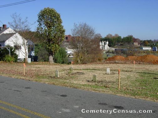
View of the original cemetery location. View of the relocation in 2005.
Surveyed by Wilma Hiatt on April 19, 2006.
Township or district: Mt. Airy.
Public or Private: Public Access.
GPS Accuracy (ft.): 12.
Elevation above sea level (ft.): 1257.
The stones were moved behind a small building left of the Church in 2005 by the church members..
Web page updated 15 April 2021
Index of All Cemeteries Alphabetical Index of All Burials Previous Page
|
|
 |