Index of All Cemeteries Alphabetical Index of All Burials Previous Page
Use the following to search across all the cemeteries listed.
Example: "Smith, Roger" (yes, use the quotes)
248 STATE LINE PRIMITIVE BAPTIST CHURCH CEMETERY
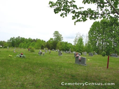
Location - Ward's Gap Rd at Parker Rd (On NC/VA State Line), Mt. Airy, Surry Co., NC.
Coordinates: 36d 33m 28.8s N; 80d 36m 42.2s W Click here for Online Maps
Directions: From intersection of Main St and Lebanon St in Mt. Airy, go north on N. Main St (changes to Ward's Gap Rd where Greenhill Rd intersects on the left) for 3.8 miles and the church and cemetery will be on the right. (When you get to the fork of N. Main and Springs Road, stay to the left).
View of the church. Another view of the church.
Surveyed by Andy Hennis on April 6, 2006.
Township or district: Mt. Airy.
Public or Private: Public Access.
GPS Accuracy (ft.): 14.
Elevation above sea level (ft.): 1308.
Status of cemetery: Currently maintained.
Web page updated 15 April 2021
Index of All Cemeteries Alphabetical Index of All Burials Previous Page
|
|
 |